- SERVICES
Stockpile Volume Survey
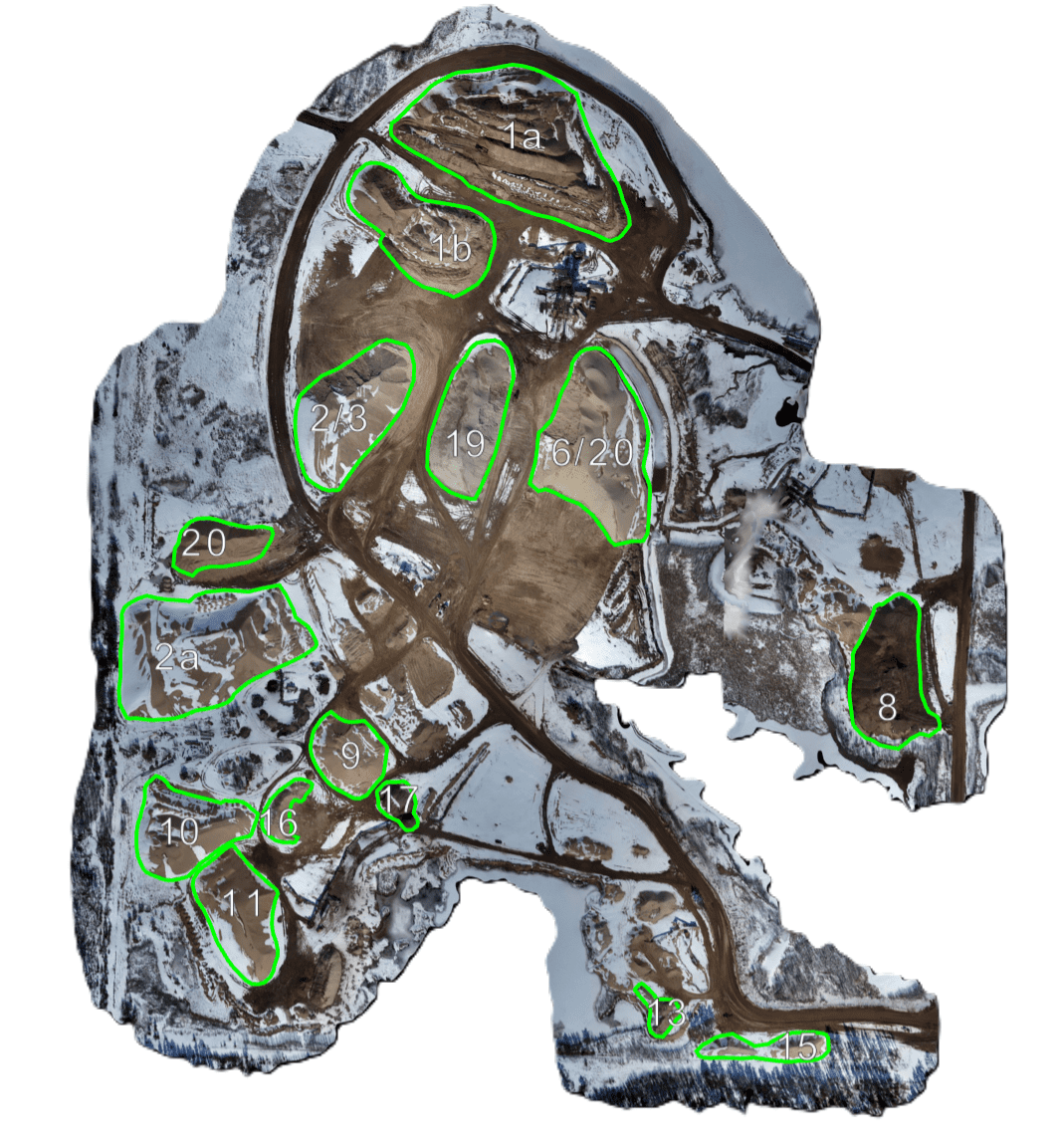
Measuring stockpile volumes with drones involves using unmanned aerial vehicles to capture images or LiDAR scans of material piles. Specialized software processes this data to create 3D models, accurately calculating the volume by comparing the stockpile’s shape to a reference surface. This method offers rapid, precise, and safe volume assessments, providing detailed reports essential for inventory management, logistics, and quality control across industries like mining, construction, and agriculture.
Deliverables
- Stockpile Volume Reports
- Cut/Fill Volume Reports
APPLICATIONS
Elevate Accuracy
Stockpile Volumetric Measurements
Fast and accurate stockpile volume reports. Keep track of aggerate inventories with survey grade volumetric scans. Depending on the complexity of the job, detailed reports can be delivered within a couple hours of executing the scan.
Cut/Fill Volume Analysis
Calculate volumes of material being moved in or out of the worksite. A topographical scan using a drone and GPS rover will take place before and after materials are displaced for accurate measurements.
Cut/Fill Volume Analysis
Calculate volumes of material being moved in or out of the worksite. A topographical scan using a drone and GPS rover will take place before and after materials are displaced for accurate measurements.