- GRANDE PRAIRIE
Drone Services in Grande Prairie
Gain a competitive edge with our advanced drone services in Grande Prairie.
Our Drone Solutions
At Crow’s Nest Drone Solutions, we offer a wide range of drone services that allow you to see things that aren’t visible to the human eye. Whether that’s an aerial view of real estate or you need to create a heat map to identify safety risks, our drone services allow you to operate your business more efficiently and more safely while giving you the tools you need to generate more revenue in your business.
Our services include everything from LiDAR drone mapping services to industrial inspections. If you need a drone pilot in Grande Prairie, contact us today for a quote.
Explore all our Drone Services
Drones are more versatile than many people realize. They not only document aerial views but they can also be used for thermal mapping and industrial inspections.
LiDAR Drone Mapping Services
Obtain accurate, detailed topographical data for all your land surveying and mapping needs. We can survey construction sites, mines and more. We can also create 2D and 3D survey maps with our drone survey and aerial mapping services.
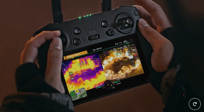
Drone Thermal Inspections
Our versatile thermal inspections can help you uncover electrical problems, plumbing leaks and more. This allows you to address issues fast.
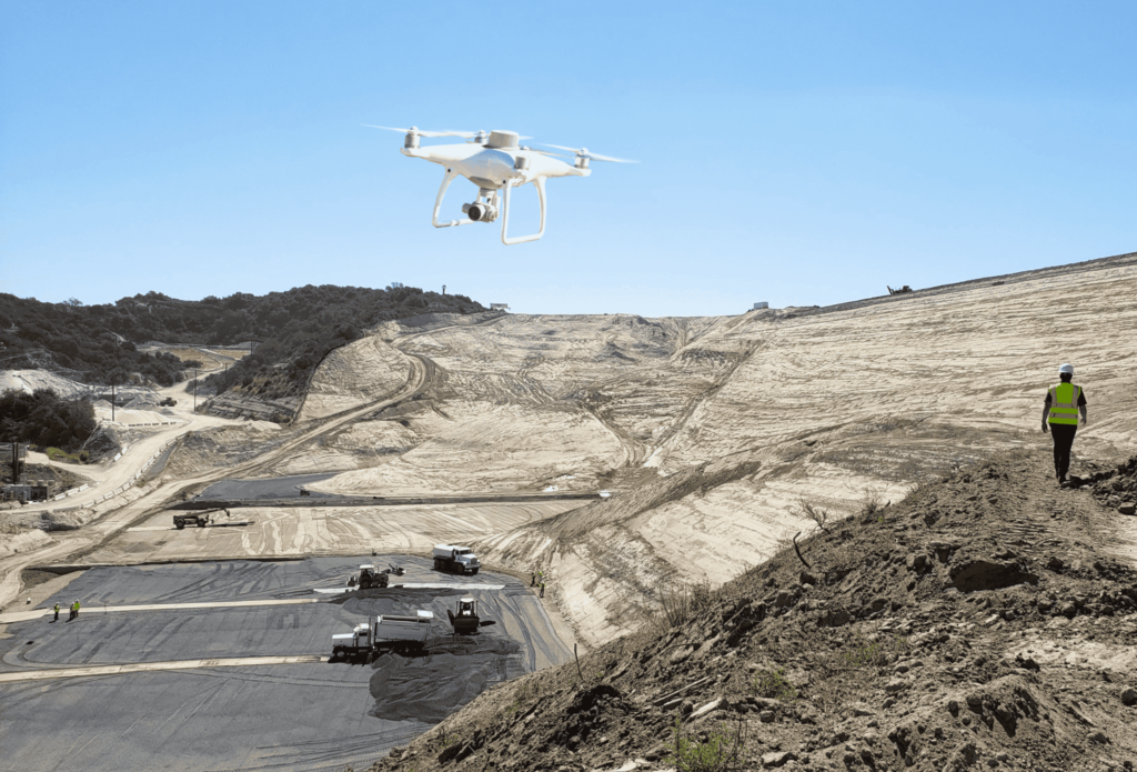
Topographical Site Mapping
Our topographical mapping service comprehensively understands your land’s features. It’s ideal for construction and environmental studies.
Drone Gas Detection
With our drone gas detection services, you can detect gas leaks before they become a hazard, resulting in a safer working environment.

Confined Space Inspections
Improve the safety of your workplace with our confined space inspections. We can navigate our drones inside vessels, inspect dangerous equipment, and more, so you don’t have to put your team at risk.
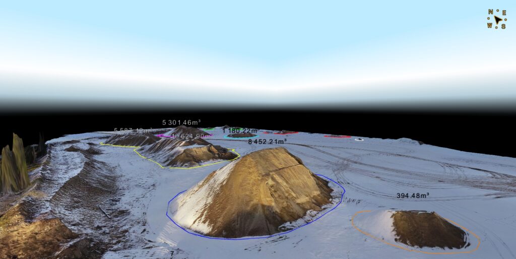
Stockpile Measurement
Easily monitor your inventory of raw materials with our stockpile measurement services. Our drones can help you quickly calculate your stockpile, saving hours of manual labour.

Drone Inspections
Our drone inspections allow you to quickly and safely assess the condition of large structures, including Stacks, bridges and more. This allows you to uncover damage and make repairs before they pose an issue.

Surveying
Achieve precise measurements and land assessments with our surveying service. This streamlines the surveying process with drone technology.
Drone Photography and Videography
Capture stunning aerial footage and photographs for any project with our drone photography and videography services. We can help you highlight real estate, capture events and more.
Industries
We offer accurate and reliable drone services to businesses in a wide range of industries, including:
- Construction
- Real Estate
- Mining
- Civil Engineering
- Agriculture
- Oil and Gas
- Environment
- Security
- Solar
- ...and many more
How it Works
Step 1: Getting Started
We’ll start with an initial consultation to determine how we can best help.
Step 2: Custom Solution
Once we know what type of drone services you need, we’ll create a customer solution for you.
Step 2: Custom Solution
Once we know what type of drone services you need, we’ll create a customer solution for you.
Step 3: Execute Your Drone Services
After we’ve crafted a plan, we’ll execute all your drone surveying services with precision